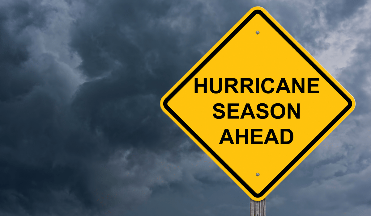
Florida Hurricane Season 2026 Explained: A Practical Guide for Residents
Luana B. Gann, Editor
6/5/2026
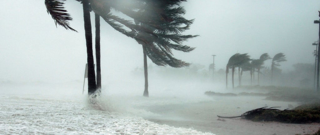
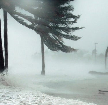
Table of Contents:
What is Storm Serge?
2026 Tax Change That You Need to Know About
A Few Florida-Specific Realities Worth Knowing
Your 2026 Hurricane Season Quick Reference Contacts
If you're a first-year Floridian, welcome. You've traded snow shovels for storm shutters. If you're a decades-long resident, you already know the drill — but there's some genuinely new information for 2026 that's worth your attention, including a permanent tax change on prep supplies, updated evacuation zones in several counties, and new AI-powered forecasting tools from NOAA.
And if you've been lulled into comfort by the headline "below-normal season predicted" — keep reading. That phrase has a catch that every Florida resident needs to understand.
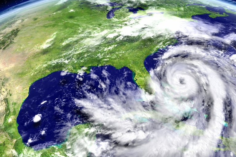
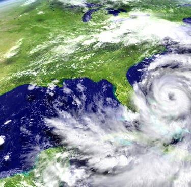
So, What's the 2026 Hurricane Season Forecast?
Let's start with the good news: NOAA is officially predicting a below-normal 2026 Atlantic hurricane season, citing a 55% probability of reduced activity. Here's what the numbers look like:
The driving force: El Niño. This naturally occurring climate pattern warms the central and eastern Pacific Ocean, which in turn pumps extra wind shear into the Atlantic — essentially chopping off the tops of developing storms before they can organize. El Niño is a known hurricane suppressor, and it's expected to be strong this season.
The season's 2026 storm name list kicks off with Arthur, Bertha, and Cristobal, should we get there.
Now the Part Everyone Skips: "Below Normal" Is Not a Day Off
Here's the honest, less-comfortable version of this story: a below-normal forecast means nothing to the town a storm happens to hit.
This is the single most important thing to understand about hurricane statistics. They're averages across an entire ocean basin. Florida doesn't care about the Atlantic basin's average — Florida cares whether a storm is aimed at us.
Consider this: Hurricane Andrew in 1992 struck during a below-normal season. It leveled entire neighborhoods in South Florida and remains one of the most destructive storms in U.S. history. One storm. Below-normal season.
Even more striking for 2026: some forecasters note that Florida may actually experience a higher-than-normal share of any U.S. hurricane activity this season, even while the overall Atlantic numbers stay low. Florida's geography — that long, exposed peninsula sticking out into two storm-generating bodies of water simultaneously — means we don't get the luxury of sitting one out just because the basin is quiet.
The bottom line from every meteorologist and emergency manager worth their salt: prepare the same way every year.
What Is Storm Surge and Why Is It More Dangerous Than Hurricane Wind?
Most people picture a hurricane as a wind event. Roof damage, downed trees, shattered windows. And yes, wind is destructive. But the number one killer in a hurricane is almost always storm surge — and far too few residents truly understand what it is.
Hurricane Ian (2022) produced storm surges up to 15 feet in parts of Southwest Florida
A surge of just 2 feet can knock an adult off their feet and carry them
Surges can reach 15 to 40 feet with the most powerful storms
Here's the part that surprises people: a storm's category number is based on wind speed only. A Category 1 hurricane with a large wind field, moving slowly, and hitting a coastline at just the right angle can produce a surge equal to or greater than a faster, smaller Category 3. Category number ≠ surge danger.
If you live near the coast or in a low-lying area, the surge map matters more than the category number. Always.
Know Your Zone — And Check It Again, Because It May Have Changed
Florida uses an A through F zone system:
A: Highest - Immediate coast, barrier islands, lowest elevation
B: Very High - Near coast, vulnerable to major storm surge
C–D: Moderate–High - Inland but still surge or flood risk
E–F: Lower - Typically only evacuated for the most extreme storms
Important for 2026: Several Florida counties have updated their evacuation zones. Hillsborough County, for example, expanded and reclassified zones this year — some areas moved to higher-risk designations, others were downgraded. If you haven't checked your specific address since last season, don't assume you're in the same zone.
→ Find your zone right now: FloridaDisaster.org/KnowYourZone Simply enter your address. Takes 60 seconds. Do it today.
For EV owners: Hillsborough County's 2026 preparedness guidance specifically addresses electric vehicles — something you won't find in older guides. The critical advice: do not charge your EV in flooded areas (lithium-ion batteries and floodwater are a dangerous combination), charge to 80% before evacuating rather than 100% (better for the battery in extended use), and plan your evacuation route around available charging stations in advance. Include this in your family plan.
Special needs residents: If you or someone in your household requires medical equipment or assistance during an evacuation, register with your county's Special Needs Registry now — before the season heats up. Don't wait for a storm watch to be posted.

The Tax Change You Need to Know About
Here's some genuinely useful news that doesn't make a lot of headlines: Florida eliminated the limited-window hurricane tax holiday in favor of making many preparedness items permanently tax-exempt year-round.
❌ Not included in the permanent exemption:
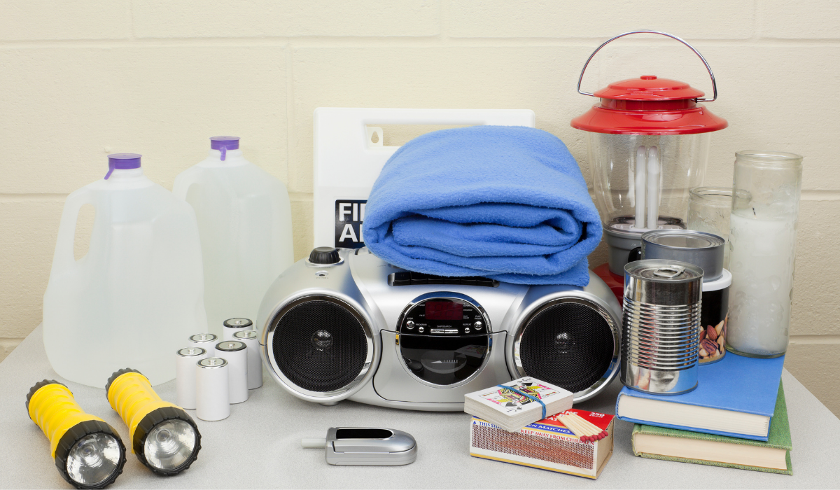
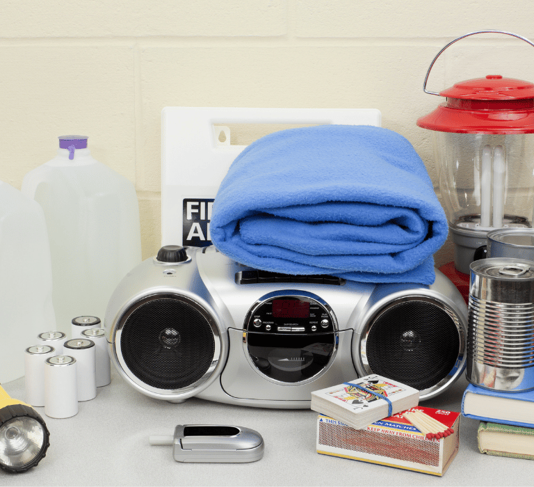
Your 2026 Hurricane Preparedness Checklist
Here's what Florida's Division of Emergency Management now recommends — and note the upgrade from the old "72 hours" standard to seven full days of supplies. Recent storms like Hurricane Michael (2018) showed that restoring power and services in hard-hit areas can take weeks, not days.
Understanding the Alerts: Watch vs. Warning vs. Advisory
Tropical Storm/Hurricane Watch: Conditions are possible within 48 hours. Time to prepare and monitor closely.
Tropical Storm/Hurricane Warning: Conditions are expected within 36 hours. Begin executing your plan now. If officials say evacuate, go.
Storm Surge Warning: This is separate from the hurricane warning and specifically indicates life-threatening inundation from rising water. This is the alert that should make coastal and low-lying residents move — immediately.
A note on the "cone of uncertainty": That famous cone you see on forecast maps does not show where the storm will hit. It shows where the center of the storm is most likely to travel. The storm's dangerous winds and surge extend well outside the cone. Many people inland have been blindsided by significant impacts because their area wasn't inside the cone.
What's New in 2026: Smarter Forecasting Tools
NOAA made meaningful upgrades to its forecasting and communication systems for 2026:
AI-enhanced storm tracking: New artificial intelligence tools are being used to analyze satellite data faster and with greater precision, improving forecast accuracy, especially in the 24–48 hour window before landfall.
Improved inland flood warnings: One of the most underappreciated hurricane dangers is freshwater flooding from rainfall, often far from the coast. NOAA has improved its inland flood products to give communities further from the coast better advance warning.
Clearer risk communication: New graphic and language standards from the National Hurricane Center are designed to make storm surge and flood risks more intuitive for residents, rather than relying solely on category numbers.
Download the FEMA App and your local county emergency management app now — before any storm forms. These push real-time alerts directly to your phone.
A Few Florida-Specific Realities Worth Knowing
For newcomers especially — a few things that longtime residents have learned the hard way:
Gas lines form fast. When a storm watch is posted, lines at gas stations can stretch for hours within a day. Keep your tank above half throughout the season. Fill up when a storm is still three or four days out, not when a warning is posted.
Grocery stores sell out of water and canned goods immediately. Buy your supplies before the first named storm of the season, not after one forms.
The storm cone makes people complacent — until it shifts. Forecast tracks can shift significantly 48–72 hours out. Residents who assumed they were safe because a storm was "aimed at Tampa" and then woke up to it turning toward their coast have made this mistake once and never again.
Not all shelters accept pets. Florida requires counties to have at least one pet-friendly shelter. Find yours at FloridaDisaster.org before you need it.
Your neighbors matter. Check on elderly or mobility-limited neighbors early in the season — exchange phone numbers, offer to help. This is something that doesn't show up on any checklist but makes an enormous difference in communities after a storm.
Florida Hurricane Season 2026 FAQ:
When is hurricane season in Florida? Florida's hurricane season officially runs from June 1 through November 30, with the peak period falling between mid-August and mid-October. September is historically the most active month. Storms have formed outside of these dates, however, and Florida residents are advised to maintain preparedness year-round rather than treating June 1 as a start signal.
What is the difference between a hurricane watch and a hurricane warning? A hurricane watch means hurricane conditions — sustained winds of 74 mph or higher — are possible in the area within 48 hours. A hurricane warning means those conditions are expected within 36 hours. A watch is your signal to prepare and monitor closely; a warning means you need to take immediate action, including evacuation if you are in a vulnerable area. Do not wait for a warning to begin preparing.
How early should I prepare for hurricane season in Florida? Before the season starts — ideally by May 1. This means assembling your hurricane kit, reviewing your evacuation route, confirming your insurance coverage, trimming trees, securing outdoor items, and establishing a family communication plan. Preparing in advance avoids the rush for water, batteries, and supplies that happens every single time a storm appears in the forecast. Florida does this to itself every year. Don't be that person at the gas station on Day Two.
What should be in a Florida hurricane preparedness kit? At minimum: one gallon of water per person per day for at least seven days, a seven-day supply of non-perishable food, a battery-powered or hand-crank weather radio, flashlights and extra batteries, a first aid kit, a week's supply of prescription medications, copies of important documents in a waterproof container, cash in small bills, a phone charger and backup battery, and any supplies specific to infants, pets, or household members with medical needs.
Should I evacuate or shelter in place during a Florida hurricane? It depends on your location, the storm's projected path and strength, and whether local officials have issued an evacuation order for your zone. If you are in a mobile home, a flood-prone or low-lying area, a coastal surge zone, or your county has ordered evacuation — leave. Do not shelter in place in a mobile home under any hurricane conditions. Know your evacuation zone before the season starts at your county emergency management website — not when a storm is already in the Gulf.
Does homeowners insurance in Florida cover hurricane damage? Standard Florida homeowners policies typically cover wind damage, but flood damage — including storm surge — is almost never covered under a standard policy and requires a separate flood insurance policy through the National Flood Insurance Program (NFIP) or a private insurer. Most Florida policies also carry a separate hurricane deductible calculated as a percentage of your home's insured value, not a flat dollar amount. Review your policy before June 1 every year and know exactly what you have.
What hurricane categories should Florida residents be most concerned about? All of them — but the response differs. Category 1 and 2 storms (74–110 mph winds) cause significant damage and demand attention. Category 3, 4, and 5 storms are classified as major hurricanes and cause catastrophic damage, frequently requiring evacuation of coastal and vulnerable areas. Florida has been struck by all five categories. Storms can also intensify rapidly — a Category 2 in the morning can be a Category 4 by landfall. Track every storm seriously regardless of its starting category.
Your 2026 Hurricane Season Quick-Reference Contacts
Know your evacuation zone - FloridaDisaster.org/KnowYourZone
Florida Division of Emergency Management - FloridaDisaster.org
NOAA National Hurricane Center - NHC.NOAA.gov
Supply checklist (printable) - FloridaDisaster.org/planprepare/hurricane-supply-checklist
Special Needs Registry - Contact your county's Emergency Management office
FEMA App - Available on iOS and Android
The Bottom Line
A below-normal 2026 hurricane season is genuinely welcome news — we'll take it. But it's news to put in proper context, not a reason to skip the prep work. Florida has seen what "just one storm" can do in even the quietest of seasons.
The best hurricane strategy is the most boring one: prepare early, prepare thoroughly, and then enjoy the rest of the summer without constant anxiety. Know your zone, build your kit, have your plan, and let June through November pass as uneventfully as possible.
We'll be publishing expanded deep-dive articles throughout the season on specific topics — storm surge, insurance, rebuilding after a storm, and more. Bookmark Florida Current, stay informed, and stay ready.
Because in Florida, prepared isn't paranoid. It's just smart.
Sources: NOAA National Hurricane Center, Florida Division of Emergency Management (FloridaDisaster.org), FSU Florida Climate Center, American Red Cross South Florida, Hillsborough County Emergency Management, National Weather Service, WMNF/FPREN, First Coast News, Tallahassee Democrat/WeatherTiger.
Editor's Note: This is the first article in Florida Current's 2026 Hurricane Season series. Expanded articles on topics including storm surge, flood insurance, building a go-bag, and post-storm recovery are coming throughout the season.
More from Florida Current:
Best Places to Retire in Florida: A Genuine Guide for Real People Making Real Decisions
The Florida New Resident Checklist: 25 Things to Do After the Moving Truck Leaves
Florida Weather Guide: Month-by-Month Temperatures, Seasons, and What to Expect
Florida native Luana B. Gann brings more than 30 years of publishing, editing, and journalism experience to Florida Current. With a deep appreciation for the Sunshine State’s culture, lifestyle, and ever-changing landscape, she is dedicated to helping readers discover what’s new, noteworthy, and uniquely Florida.


CONTACT
Reach out for questions or feedback anytime.
contact@FLAcurrent.com
© 2026. All rights reserved.